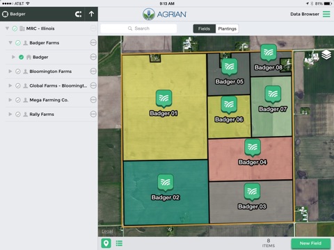
TELUS Agronomy is the powerful, new mobile companion to the next generation TELUS Agronomy web application that provides crop advisors, consultants and growers with an innovative suite of precision agronomy and compliance tools. Seamless, real-time data syncing and full offline capabilities allow field-based users to remain informed and productive at all times.
NOTE
• Use of this app requires an Agrian user account with advanced access.
• Continued use of GPS running in the background can dramatically decrease battery life.
MOBILE DATA MANAGEMENT
• Create and manage grower, farm, field and planting records and boundary maps
• Full editing capabilities while disconnected in the field
• Boundary mapping with external GPS integration and auto-smoothing capabilities
• Quick and accurate manual mapping with polygon, circle and split drawing tools
• Multiple map background imagery providers (Apple, Google, Bing, etc.)
CLOUD SYNC
• Real-time background cloud sync automatically keeps everyone updated
• Data synced from the device in real-time as records are created while connected
• Data generated while offline is queued and sent automatically once a connection is detected
• Two-way sync keeps all mobile devices in sync within minutes of any change
• Robust permissions model prevents syncing and viewing of unauthorized data
FIELD SCOUTING
• Create geo-referenced scouting observations and attach photos and notes
• Record pest observations for disease, insects and weeds
• Record additional observations for nutrient deficiencies, soil moisture, crop damage and more
• Share observations via text message directly from the field
• Synchronize observations in real time with your co-workers or customers
FIELD SAMPLING
• Offline GPS-enabled soil and plant sample collection
• Grid, zone, target and freeform sampling modes for point and composite samples
• Sample using targets generated from field imagery, logged data (planting, harvest, EM, etc.), soil samples and more
• Request lab recommendations for your sampling job
• Share sample information sheet directly from the field via text message, email and more
IMAGERY / MAP OVERLAYS
• Access in-season imagery from multiple providers for your fields
• Easily view available image dates and switch between layers with a single tap
• View map overlays for planting, application, harvest records and more when scouting or sampling fields
• Utilize location information along with imagery and map overlays for powerful guided scouting
• Access in-season imagery and map layers to validate sample event locations


